Reducing the costs to design firms from the word go!
SUplaceMaker, by Daniel Tal.. Brilliant!
How many weeks, days, months do you waste before you actually start designing the dwellings?
Developers/town planners and architects traditionally waste weeks of time on feasibility study preparation. Setting out large projects should be easier, it took foresight, frustration and determination to come up with a solution.
Why would I need SuPlacemaker?
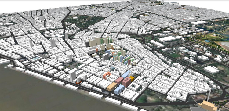
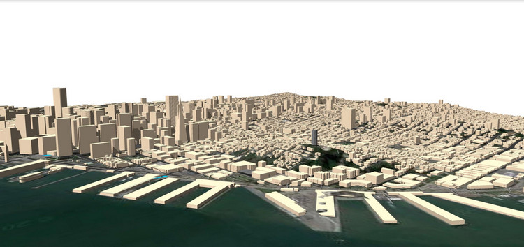
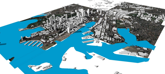
PlaceMaker fits several needs for design professionals. First, it provided access to data sets, 3d buildings, roads, site plan and street views, that are either not available or would take hours, days if not weeks to create. And the high-resolution aerials really help understand a project location and start placing project studies into real-world context.
Provides many uses
Firms and designers will be able to use it for planning studies, rendering and viz, understanding view corridors and providing important context for architects, urban planners and landscape architects. Also, it will have automated the modelling process onto terrain providing a great starting base model while providing a more context-rich environment. There are so many more uses for this information and type of model.
Save time and money
And aside from the uses, it will save time. You can generate several miles of building and road models. This would take hours, days if not weeks to normally do. The savings PlaceMaker provides more than pays for itself in one project in terms of savings.
Easy to use
We made PlaceMaker easy to use. As one user stated, we follow the SketchUp philosophy of keeping it simple and direct. We see it as important to make it accessible to even the newest SketchUp users. We took great care to make sure it was no complicated to get started.
Take a Tour
One feature we have not highlighted enough in our videos is the Tour feature. We synced the PlaceMaker to Google Street View. So once you import a location aerial, streets and buildings, turn on the PlaceMaker Tour and you can see your location relative to the street view. You can even pan around in the street view and it will move you around the model and vice-versa. This provides immersive important context and understanding. Then you can even PhotoMatch building textures onto massings.
make the job easier?
Must Have Tool
PlaceMaker adds loads of value to 3D projects, regardless of the project type or use. It will allow designers to better communicate ideas within a city or location. And we have large plans for the future of PlaceMaker. This is just version 1. We hope to provide even more data and options in future versions.
Need more information?
To get started, check out Daniels Website www.suplacemaker.com
Leave a Reply
You must be logged in to post a comment.